Description
Accommodation
Features
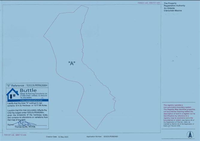
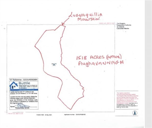
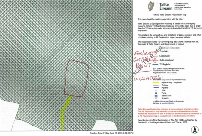
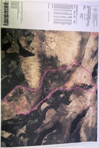
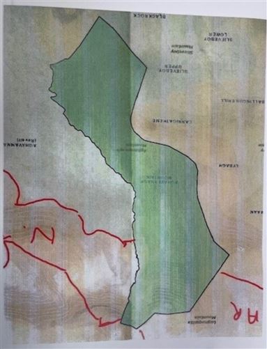
- c.1518 acres: heather, rough grazing and some bog
- . 0.61 acre of enclosed land, Access via Right of Way.
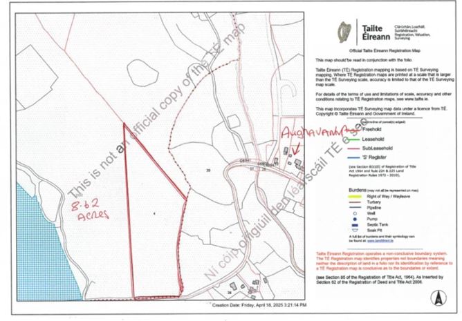
- . 8.62 acres adjacent public road
- Suitable for sheep grazing
Negotiator
Show more...
| Beds | |
| Price | €2,000,000 |
| Property Type | Farm Land |
| Size | 0 meters2 |
| Energy Rating | BER- |
| Refreshed on | |
| Eircode | |
| Group Name | Farrell Auctioneers & Estate Agents LTD |
| Sales License Number | 003731 |
Description
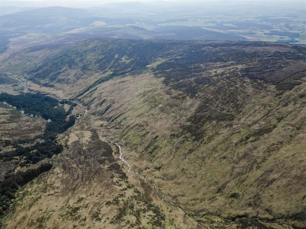
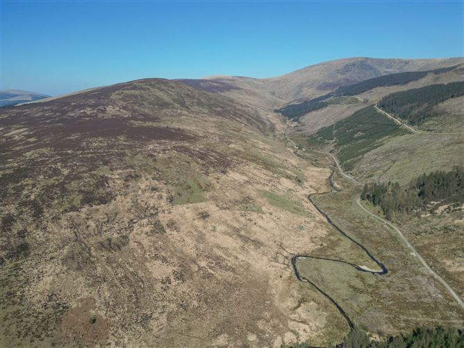
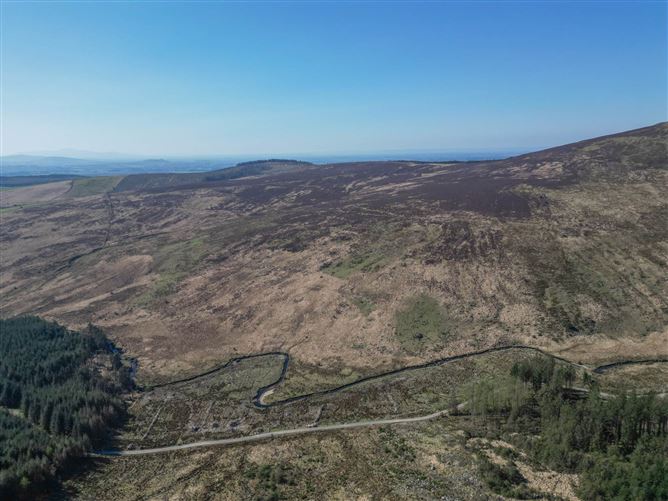
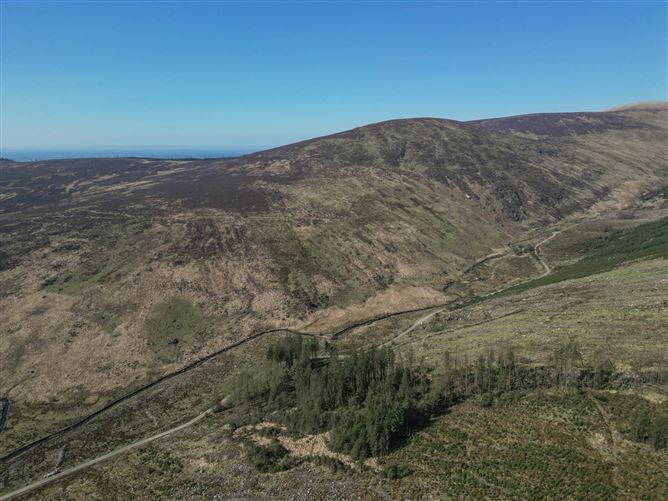
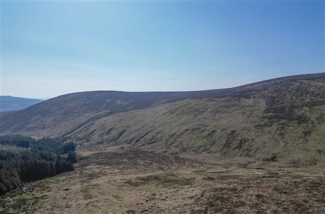
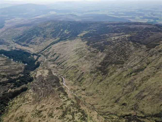
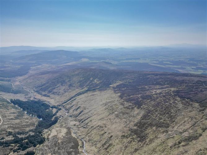
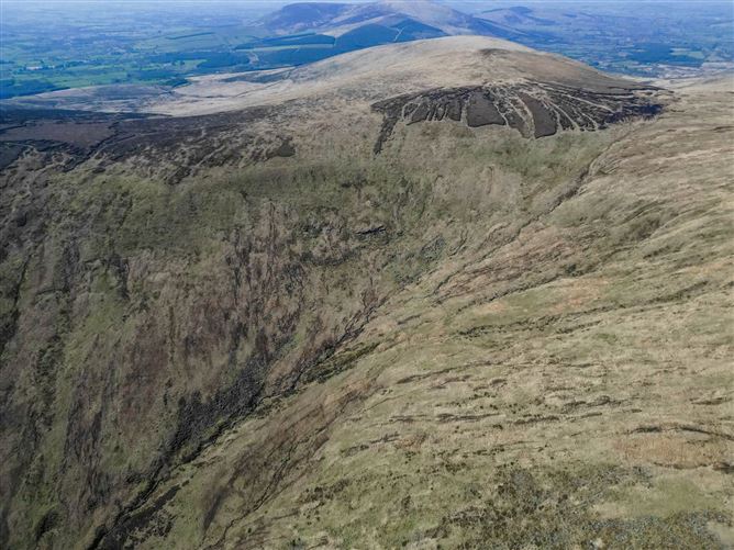
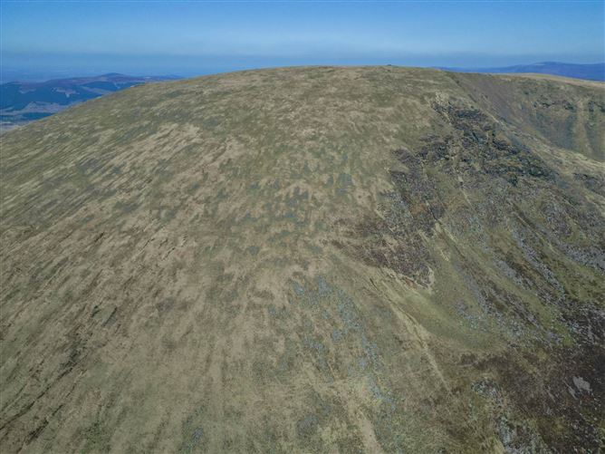
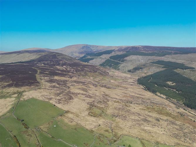
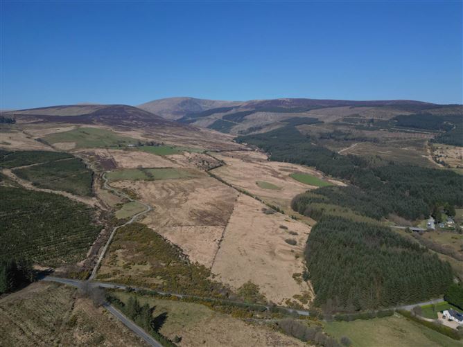
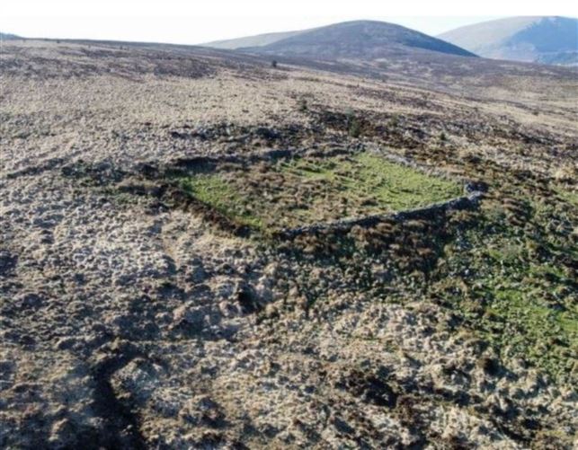
Farrell Auctioneers, Valuers & Estate Agents Limited are delighted to bring to the market an extensive Aghavannagh Mountain Holding, being sold Fee simple, comprising: - c.1518 acres. These lands run in a large open hill from Aghavannagh towards Lugnaquilla and comprise of heather, rough grazing and some bog, with its boundary being the River Ow. Note: these lands are subject to grazing rights. - c. 8.62 acres adjoining the Aughrim to Aghavannagh Road, contained in Folio WW47447F (Plan 3), situated beside the public road and is rough grazing land, suitable for forestry or grazing purposes. Coordinates: 705287, 686025 Farbreaga, Ballincor South, Wicklow. - c. 0.61 acre of enclosed land, contained in Folio WW47447F (Plan 3). Access via Right of Way. Coordinates 704804, 686749 Farbreaga, Ballincor South, Wicklow, This is a unique opportunity to acquire property in the heart of the Wicklow mountains, located in the South of County Wicklow and accessed via the Aghavannagh Road. The lands extend to Lugnaquilla Summit (925 meters), which we believe is the second highest mountain in Ireland, after County Kerry, the highest mountain in Wicklow and the highest point in Leinster and is an imposing giant of a mountain. On visiting the Summit, we can report, that the Summit is approximately 100 acres of plateau and not a peak, like on other mountain ranges. This flat plateau at the top of the climb is referred to as Percy`s Table, and is a historic benchmark, situated at the Summit over-looking Co. Wicklow `the Garden of Ireland` which is suitable for rough grazing, even at that height. This Summit is one of the most spectacular spots in Co Wicklow, looking out over the entire County and on a clear day some say Snowdonia in Wales. This farm meets The Wicklow Way, a recognised walking trail first proposed in 1966, it is a natural attraction in Ireland, drawing tourists from all over the world. is a long-distance challenging hiking trail that runs through a variety of terrain through the Wicklow Mountains that offers stunning views of the Irish countryside and a chance to experience the National beauty of the Wicklow Mountains. The National Park covers over 20,000 hectares of varied and scenic terrain, including mountains forests lakes and rivers and attracts visitors throughout the year with peak times during the summer months and on weekends. It is a popular destination for hiking cycling, fishing and other outdoor activities as well as for its rich cultural and historical heritage. It passes through several notable landmarks including Glendalough Monastic Site, the Powerscourt Waterfall, and Lough Tay also known as the `Guinness Lake` due to its dark Peaty Water, and once one of the homes of the Guinness Family. Aghavannagh its name in Irish: Achadh Mheánach, meaning `hilly field` is a small villagem situated near the base of the Lugnaquilla massif, and within a few miles of Aughrim, Glenmalure and Tinahely to the east and south, and Kiltegan, Hacketstown and Baltinglass to the west. The area is mainly surrounded by forests and is composed of mountains and mountain land. This mountainous terrain is where the Ow river rises on the southern slopes of Lugnaquilla, flows through a glacial valley and passes the outskirts of the village meeting the Aghavannagh river, which is much smaller and flows through the village, a short distance to the south. It is located in the barony of Ballinacor South on the Military Road, originally constructed between 1804 and 1809, in the wake of the 1798 rebellion. It is so remote that inhabitants say that "Aghavannagh is the last place God made". Directions: Head south-west from Glenmalure towards Aghavannagh to arrive at Yurts and Garden Rooms, Aghavannagh, Co, Wicklow Y14 KF72, continue passed the forestry and the property is the next open land immediately after the forestry on your right hand side For further information please call our office on 00-353 91 632-688 or email colm@colmfarrell.com Note: All measurements are approximate and photographs provided for guidance only.
Accommodation
Notice Please note we have not tested any apparatus, fixtures, fittings, or services. Interested parties must undertake their own investigation into the working order of these items. All measurements are approximate and photographs provided for guidance only.
Features
Negotiator
Colm Farrell
Date created: Apr 18, 2025