
Ballynafid Neighbourhood Guide
Westmeath
About Ballynafid
Ballynafid is a small rural locality in County Westmeath, east of Mullingar and within the wider N91 area, surrounded by farmland, lakes and scattered villages. It has a peaceful countryside character rather than a traditional village centre, making it suited to residents seeking space and a quieter setting while remaining within reach of Mullingar’s services. Nearby Ballinalack, Crookedwood, Multyfarnham and Rathconrath provide local community connections, while Mullingar is the principal centre for larger shops, schools, healthcare, restaurants and leisure facilities. Families generally rely on nearby national schools and Mullingar’s wider choice of primary and secondary education, with school transport often important in rural areas. Road travel is central to daily life: the N4 and N52 around Mullingar provide useful connections towards Dublin, Longford, Athlone and other Midlands towns, while local bus services are more limited than in urban areas. Shopping and everyday errands are typically handled in Mullingar, which has supermarkets, independent retailers, cafés, pubs and restaurants, alongside larger amenities such as Mullingar Library and the county’s leisure facilities. The surrounding countryside supports walking, fishing and outdoor recreation, with Lough Owel and the Royal Canal region among the notable nearby landscape attractions. Ballynafid itself is quiet and community-oriented, with local GAA and parish networks helping connect residents across the surrounding townlands and villages.
Property Market in Ballynafid
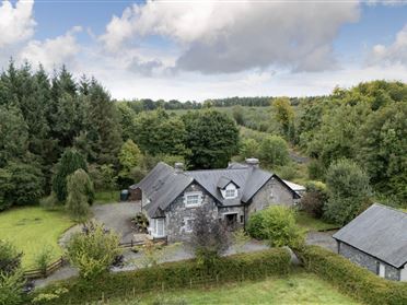
Based on 4 properties for sale in Ballynafid
Property types
Bedrooms
What’s in Ballynafid
Schools
Local primary school serving children from Ballynacargy and surrounding rural communities.
Nearby rural primary school serving families around Ballinalack and neighbouring townlands.
Mullingar secondary school providing post-primary education for boys.
Established Mullingar secondary school offering post-primary education for girls.
Mixed post-primary school providing broad academic and practical education options.
Transport
Plan your journey ↗Regional route connecting Ballynafid with Mullingar, Ballinalack and surrounding Westmeath villages.
Major national route providing westbound and Dublin connections from the Mullingar area.
Irish Rail station serving Dublin Connolly, Maynooth, Longford and intermediate destinations.
Regional bus connections linking Mullingar with Dublin, Athlone and nearby towns.
Local services provide access around the town, with rural connections more limited.
Amenities
Main nearby retail area with supermarkets, independent shops, services and everyday amenities.
Public library offering books, study facilities, digital services and community activities.
Municipal leisure facilities supporting swimming, fitness and indoor recreational activities.
Popular lakeside heritage attraction with gardens, woodland walks and family activities.
Broad selection of dining and social venues concentrated throughout Mullingar town centre.
Nearby lake valued for scenery, walking, fishing and water-based countryside recreation.
Main nearby hospital providing acute, outpatient and community healthcare services.
Local Clubs & Businesses
Prominent Gaelic games club serving Mullingar and the surrounding Westmeath community.
Local rugby club offering playing and social opportunities for several age groups.
Established athletics club supporting training, competition and junior participation.
Represents local businesses and supports commercial activity across the Mullingar area.
Nearby venue hosting local activities, meetings and community events.




Nearby Areas
About this guide: This neighbourhood guide includes content generated with the assistance of artificial intelligence and images sourced from third-party platforms including Wikipedia. While we aim for accuracy, details such as local amenities, transport links, schools, and property data may change or contain errors. This content is provided for general informational purposes only and should not be relied upon as a substitute for independent verification. MyHome.ie accepts no liability for inaccuracies, omissions, or decisions made in reliance on this content.